
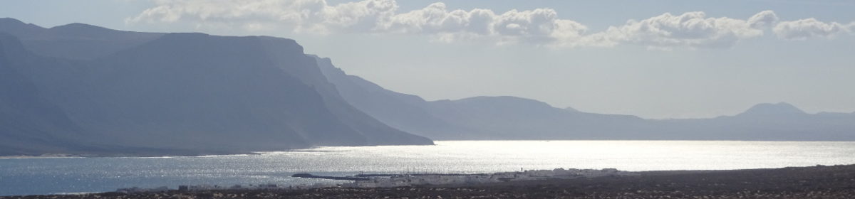
I well remember cycling across the Alps in “the good old days” using marked up maps that we had added our route to before leaving home. I remember the frustration as the map and the scenery differed and the freezing alpine river crossing that resulted from a navigational error.
You still see cyclists stood at a junction pouring over a route book or trying to open their map as the wind attempts to rip it from their hands. Some people just love paper and this article is definitely not meant for them. If however you have a GPS receiver or even a GPS enabled phone, then you have probably already tried following a route that you either downloaded from the Internet or received from a friend. This article will take you a step further by describing how to create your own routes with free software.
Collecting and collating
As so often in life the important thing is to be as lazy as possible. Start by searching the Internet for people who have already cycled the route that you are planning. Ideally we are looking for routes that have been posted as a list of coordinates, typically as GPX or KML files.
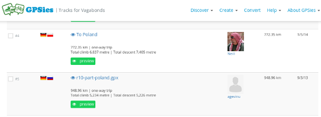
A great place to start is at GPSies but there are numerous other such sites. Download any interesting routes to your computer. If the site offers a choice of formats then chose the KML (Google Earth) format.
Often no one has cycled from your start to end point particularly if they are far apart and less known. When we cycled to Rome in 2015 there was no lack of routes available but a year earlier we cycled to a tiny village in Poland and there were no routes going there. If this is the case then look for routes that either go part of the way or overshoot your destination.
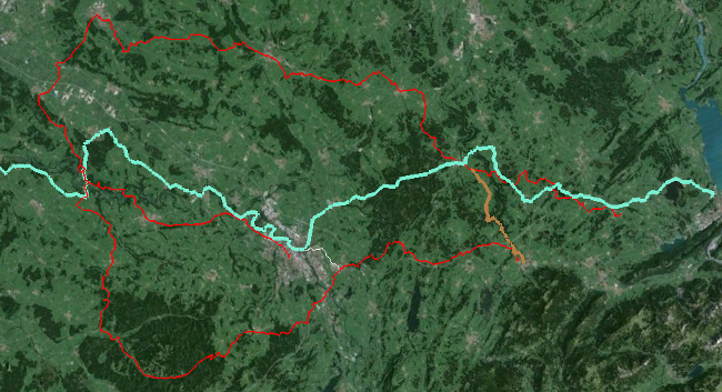
Once you have possible routes and route segments downloaded to your PC, convert any that are not in KML format. GPSies is a great tool for this. All your routes can now be opened with Google Earth and you have a first overview of the existing routes. Don’t be put off if the whole thing looks a mess – too much data at this point is better than too little.
Selecting
The advantage of Google Earth is that you can now switch the individual routes on and off and study each one in great detail. It will immediately be obvious that a few are not what you are looking for. If you enjoy meandering through the countryside, then the race bike track along the main road is not going to be for you. Equally some people enjoy crossing mountains just to keep in shape which may also not be your thing.
You will notice that many routes are similar in part. This either suggests that there is really only one sensible choice or that a well used cycle route exists. In other places there are a variety of parallel routes. Here you need to compare the surface and gradient before making your decision. You can view the profile in Google Earth and by zooming in to the satellite imagery you can (usually) guess at the surface.
Modifying
The routes can be modified in Google Earth. If you only want to use part of a particular track, then you can delete the additional points at each end. You can also clean up places where the track takes an unnecessary detour or add additional points where you want to take a slightly different route.
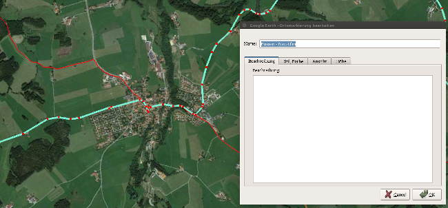
Particularly in built up areas, it is worth zooming right in and making use of the hidden path across the common or the footbridge across the river. I well remember the expression on a locals face in Rome when I guided him across a tiny bridge he didn’t even know existed or the comments from a group of friends when I took them between the farm house and the muck heap and then down a hidden path to the stream.
The satellite imagery is ideal for finding “secret” tracks. Often paths through forests can be identified by the dark line where the foliage doesn’t quite meet overhead. Similarly paths across fields show up as lighter or darker strips.
In Google Earth it is not possible to select multiple points and delete them all at once. If you want to do this then one way is to load the track to GPSies and use the editor function. There is an option called “select and remove points” which removes all the points in a previously selected area.
Creating
Once you have modified all the “borrowed” routes there will probably still be some sections of your journey that are missing. For these you must either extend your existing routes to meet each other or create new ones.
Asking Google Maps for directions and selecting the pedestrian or cyclist option can sometimes lead to a good basic route but too often it suggests main roads. Trying to get your route out of Google Maps and in to Google Earth can be frustrating as the method seems to continually change. There are however pages and pages of help online where various workarounds are described.
In Google Earth you can manually create a new route. Begin with start and destination and then look for any rivers, motorways, mountain ranges or railways in between. For each of these obstacles find a suitable “crossing” and add these to the route. After that the points have to be joined via roads, tracks or paths.
Joining
By now you should have a selection of routes in Google Earth that together form a continuous thread from start to finish. Possible some of the tracks run in the wrong direction and they all now need to be combined in to one route.
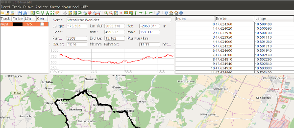
A tool that can reverse and combine routes in GPX and KML format very well is JGPSTrackEdit. This is a Java application which needs installing on your computer. It is powerfull and has a lot of options but there is a good handbook.
Finished

The route can now be loaded in to GPSies to confirm that all is as required and then exported in to any format your GPS receiver of phone requires.
On average it takes about one hour of planning for eight hours of cycling to create a “perfect” route. This is time well spent because once the route is in the receiver you just follow it and there is no necessity to stop at any junction or wonder which road to take during the ride.
Examples of routes created with the above method are:
A note on terminology. I have used the word route throughout this article. Google use the word paths. Garmin, JGPSTrackEdit and GPSies use tracks. But we are all talking about the same thing.
3 thoughts on “Easily creating a GPS bike route with free tools.”