

After a long pause I am returning to sailing. This year I took the RYA day skipper course and exam. A part of the course was about navigation and if you believed what you were taught then you could be forgiven for thinking that it was all about understanding the charts and pilotage notes and applying them.
Then I flew to Spain for two weeks sailing and the truth turned out to be a little different. In reality everything seems to be a best guess and the only truth is what you discover when you get there.
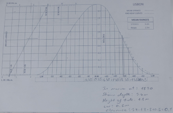
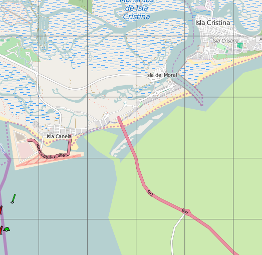
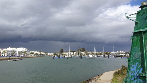 One evening we planned on sailing in to the Isla Christina Marina so we studied the admiralty chart #0093 which showed the area. It was immediately apparent that we would need to be entering at high tide as it showed a charted depth of 0.2 meters at the entrance bar and 0.6 meters just before the marina. The Navionics App on my tablet disagreed and showed a charted depth at the bar of 4 meters and 1.5 meters in the river. Luckily we had a knowledgeable local who told us that the bar is definitely dredged for the fishing fleet and that the 1.5 in the river was more realistic. We also rang the marina who assured us that with our draught of 2 meters we would „have no problem“. A later search in the Internet had pages saying “3 meters at harbour entrance”. In the end it turned out that the Navionics data was almost spot on as regards depths but how was I to know that?
The charts and App also show a leading line which can be navigated by lining up two posts or lights. Our local told us that these have not existed as long as he has been in the area. At night we ended up following a back bearing on the safe water bouy. There is also a starboard buoy that the charts and App say flashes twice in 7 seconds but it now seems to flash three times. A buoy flashing 3 times green is charted nowhere.
We had a pilot book on board but there was no mention of any of the above.
So now I have a lot of actual information about the approach to this marina and what do I do with it? If it was information I had gained cycling then I would log on to OpenStreetMap and add it all in there or correct the existing data but sadly there doesn’t seem to be a similar pool of knowledge for sailors.
OpenSeaMap shows nothing at all in the area and appears to show land and roads where there is really sea. The community layer of the Navionics App is full of non existent buoys and buoys on land – not confidence building. In the Internet, I can not find a database that seems authoritative or which is “up to date” enough to motivate me to add my knowledge.
It is all very frustrating, especially after years of working on OpenStreetMap and seeing what collaborative effort can produce.
[update 12. July 2016] I revisted OpenSeaMap and it has been cleaned up. I have also seen that other ports east and west of Isla Christina have their navigation marks added. Maybe I just hit a bad port on a bad day.